Property Record
200 Ross St, Carrollton, GA 30116


NEARBY LISTINGS FOR SALE OR LEASE
Property Detail
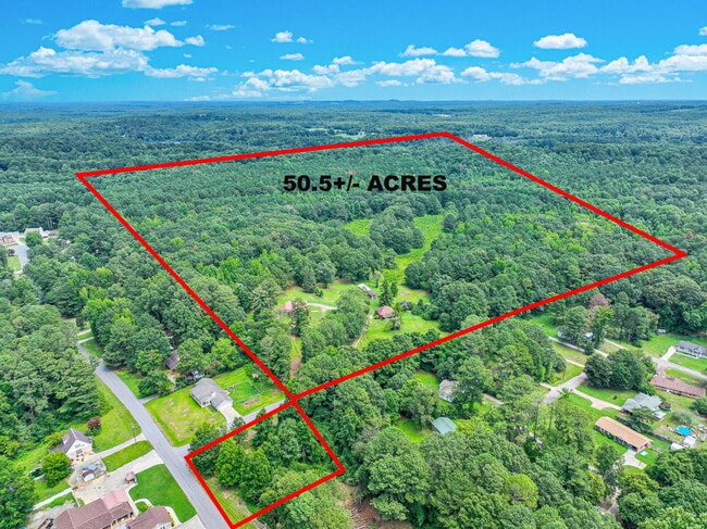
200 Ross St
107-0090
V/40.76AC ROSE ST
Agriculturalland
Carroll
X
Georgia
13045C0256D
40.76 AC
2025
Villa Rica/West Outlying
2025
Atlanta
910709
Atlanta-Sandy Springs-Roswell, GA
2,664 SF
DEMOGRAPHICS near 200 Ross St
1 Mile
3 Mile
5 Mile
2024 Total Population
2,401
18,406
44,328
2029 Population
2,629
20,308
48,916
Pop Growth 2024-2029
+ 9.50%
+ 10.33%
+ 10.35%
Average Age
36
37
36
2024 Total Households
889
6,806
15,863
HH Growth 2024-2029
+ 9.45%
+ 10.37%
+ 10.53%
Median Household Inc
$58,349
$49,374
$47,449
Avg Household Size
2.70
2.60
2.60
2024 Avg HH Vehicles
2.00
2.00
2.00
Median Home Value
$147,986
$177,352
$201,677
Median Year Built
1983
1985
1987
Nearby Places
Map Layers
Map Styles
 Street
 Aerial
- Restaurants
- Banks
- Shops
- Fitness
- Groceries
SALE & LEASE HISTORY
LISTING DATE
SALE/LEASE

Aug 27, 2024
For Sale
Nearby Properties
Address
Land Use
TOTAL SIZE
Lot Size
Zoning
Address
Land Use
TOTAL SIZE
Lot Size
Zoning
73,900 SF
10.57 AC
C2
Address
Land Use
TOTAL SIZE
Lot Size
Zoning
44,708 SF
9.92 AC
RESIDENTIA
Address
Land Use
TOTAL SIZE
Lot Size
Zoning
56,458 SF
21.87 AC
R3
Address
Land Use
TOTAL SIZE
Lot Size
Zoning
56,288 SF
4.69 AC
C2
Address
Land Use
TOTAL SIZE
Lot Size
Zoning
163,568 SF
16.80 AC
C2
Address
Land Use
TOTAL SIZE
Lot Size
Zoning
90,800 SF
10.89 AC
C2
Address
Land Use
TOTAL SIZE
Lot Size
Zoning
90,485 SF
10.35 AC
C2
Address
Land Use
TOTAL SIZE
Lot Size
Zoning
45,480 SF
62.18 AC
R20
Address
Land Use
TOTAL SIZE
Lot Size
Zoning
135,902 SF
121.50 AC
A
Address
Land Use
TOTAL SIZE
Lot Size
Zoning
29,561 SF
5.89 AC
C2
Address
Land Use
TOTAL SIZE
Lot Size
Zoning
16,743 SF
10.92 AC
R2
Address
Land Use
TOTAL SIZE
Lot Size
Zoning
100.74 AC
PUD
Address
Land Use
TOTAL SIZE
Lot Size
Zoning
63,888 SF
8.40 AC
I
Address
Land Use
TOTAL SIZE
Lot Size
Zoning
96.23 AC
M1
Address
Land Use
TOTAL SIZE
Lot Size
Zoning
46,146 SF
5.74 AC
C
Address
Land Use
TOTAL SIZE
Lot Size
Zoning
25,341 SF
3.54 AC
C2
Address
Land Use
TOTAL SIZE
Lot Size
Zoning
39,147 SF
9 AC
R2
Address
Land Use
TOTAL SIZE
Lot Size
Zoning
27,572 SF
1.71 AC
C2
Address
Land Use
TOTAL SIZE
Lot Size
Zoning
22,580 SF
9.71 AC
R2
Address
Land Use
TOTAL SIZE
Lot Size
Zoning
32,390 SF
9.84 AC
R2
Address
Land Use
TOTAL SIZE
Lot Size
Zoning
22,800 SF
39.40 AC
M1
Address
Land Use
TOTAL SIZE
Lot Size
Zoning
13,632 SF
5 AC
R2
Address
Land Use
TOTAL SIZE
Lot Size
Zoning
34,158 SF
26.14 AC
A
Address
Land Use
TOTAL SIZE
Lot Size
Zoning
9,920 SF
1.17 AC
C2
Address
Land Use
TOTAL SIZE
Lot Size
Zoning
38,400 SF
4.77 AC
I
Address
Land Use
TOTAL SIZE
Lot Size
Zoning
38,182 SF
28.01 AC
C
Address
Land Use
TOTAL SIZE
Lot Size
Zoning
29,210 SF
9.06 AC
R2
Address
Land Use
TOTAL SIZE
Lot Size
Zoning
89.72 AC
C2
Address
Land Use
TOTAL SIZE
Lot Size
Zoning
49,414 SF
8.80 AC
RM10
Address
Land Use
TOTAL SIZE
Lot Size
Zoning
5,121 SF
2.56 AC
C2
The World's #1 Commercial Real Estate Marketplace
Connect with us
© 2025 CoStar Group
The information above has been obtained from sources believed reliable. While we do not doubt its accuracy we have not verified it and make no guarantee, warranty or representation about it. It is your responsibility to independently confirm its accuracy and completeness. Any projections, opinions, assumptions, or estimates used are for example only and do not represent the current or future performance of the property. The value of this transaction to you depends on tax and other factors which should be evaluated by your tax, financial, and legal advisors. You and your advisors should conduct a careful, independent investigation of the property to determine to your satisfaction the suitability of the property for your needs.